The Exploration Process
Mineral exploration is a set of processes that are followed to discover whether economic minerals occur in a particular area.
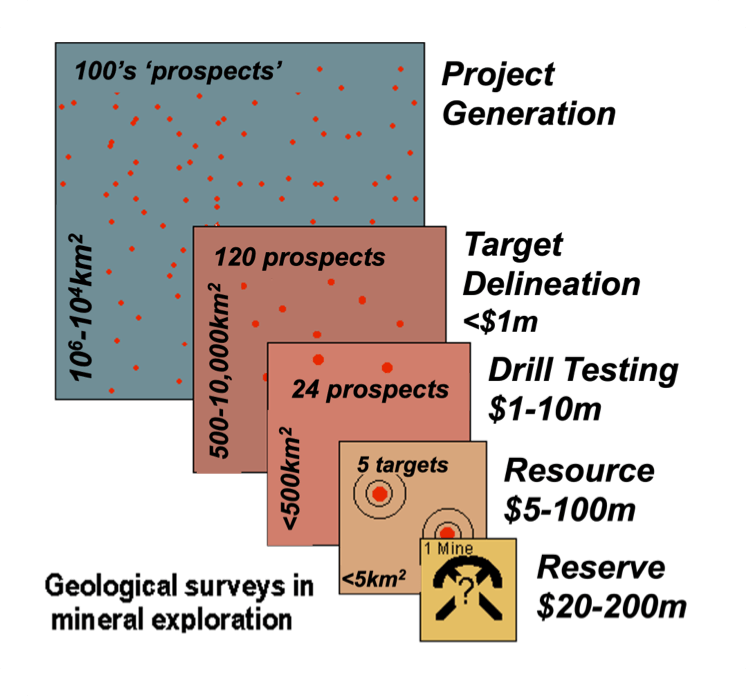
The process generally begins with broad-scale exploration over a wide region that, as targets are identified, narrows down to thorough investigation, usually through drilling and sampling.
The various exploration steps required to make a discovery can be broken down into stages and the decision whether to progress to the next stage is determined by the results of the previous stage. The exploration process can therefore take several years to complete.
Exploration Stages
Greenfields prospect > reserve probability <1%
Brownfields prospect > reserve probability >5%
Community engagement
We are committed to ongoing community engagement throughout our exploration activities which involves listening to the concerns of the community, responding openly and transparently and using community feedback to inform decision making.
Our approach to community engagement involves:
- Responding to queries and understanding your concerns and how you would like to be engaged
- Identifying appropriate steps to mitigate any concerns
- Providing verifiable, scientifically based information to address concerns where we can
- Letting you know how community feedback has been used to inform decision making
- Where possible, maximising local procurement, local employment and training opportunities
- Identifying opportunities for community collaboration and partnership
Permits
Other than prospecting activities, most exploration activities require tenements or claims that grant the holder the mineral rights to the subsurface lands. Activities usually require further stringent government permits and approvals to complete work programs.
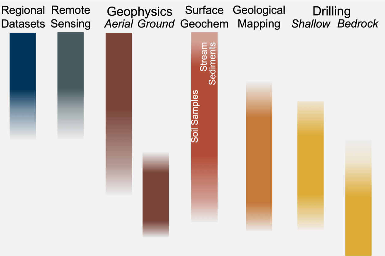
Low impact surface activity
The early stages of our mineral exploration program involve low impact surface activities:
- Stream sediment sampling – samples of silt and clay (up to 2kg) are gathered by hand from sites along stream courses, generally at stream junctions.
- Rock sampling – fragments of rock are chipped from rock faces using a small handheld hammer. These samples are up to 5kg in weight and are often collected during geological mapping.
- Geological mapping – a geologist records the characteristics and distribution of various kinds of surface rock. These observations are plotted on a map which forms the foundation for interpreting of the geology of the area.
- Soil/till sampling – a geologist will collect up to 1kg of sub-surface soil, using a spade or hand auger. Auger holes are back-filled and sods replaced afterwards. Distance between samples vary from 25m to 200m apart.
- Passive ground geophysics – a portable instrument is placed on the ground for a few minutes while it measures and records rock properties, such as gravity.
- Active ground geophysics – resistivity surveying introduces a low-voltage current into the ground at two locations and then measures the electric field this forms in the ground at a range of locations away from these points.
- Access to field areas – this will be via light-vehicle, boat and/or on foot. At times, a helicopter may be used to access more remote areas.
Drilling
If the results of our low impact surface activities indicate that there may be viable gold deposits, drilling is then required to better understand the geology and verify the results.
Before drilling commences, an assessment of potential environmental effects, cultural and safety concerns is undertaken. Stakeholders will be consulted to ensure that all relevant concerns have been appropriately addressed.
The drilling process involves using various drill rig types to drill 10-20cm wide holes to varied depths at varied angles. The rig may take up to several weeks to complete work at a site. Additional drilling may then be planned if initial drilling results are positive.
When drilling work is finished all equipment is removed and all sites are rehabilitated to the same or better condition than before activities began.
The drilling process results in core or chip samples that can be studied and analysed. The results of many holes are used to measure and define the size, shape and grade of an orebody that could potentially be mined.